Between Troy, MT south of the Pacific Northwest Trail in NW Montana and the system of trails heading north from Thompson Pass to near Trout Creek, MT, the current proposed Inland Northwest Trail (INT) route traverses the Cabinet Mountain Wilderness, where I’ve always hoped a relatively non-technical “hiking” route across the wilderness area would be possible. After several summers of failing to squeeze an attempted traverse into my weekend warrior hiking schedule, Friends of the Inland Northwest Trail volunteer Ken Vanden Heuvel told me about his own plan to attempt the traverse that he had been scheming over for quite some time. While I wanted to join him on the trek, INT route recon missions elsewhere, and my own plans to find the best route across the Selway Bitterroot Wilderness, were eating up the bulk of my vacation time. Thankfully, Ken seems to thrive on challenging, long solo hikes in the middle of nowhere, and he followed through with his plans to attempt the Cabinet Mountain Wilderness traverse this summer. The following story is Ken’s account of his adventure. (Derrick Knowles)
Route Finding the Inland Northwest Trail across the Cabinet Mountain Wilderness
I’ve lived in the Inland NW since the fall of 2008. During my vacation to explore the area to decide if I wanted to move here, one of the hikes I did was to Little Ibex Lake in the Cabinet Mountain Wilderness (CMW) of NW Montana. The setting of this lake is so picturesque and peaceful, I immediately fell in love with the Cabinets and couldn’t wait to move. Since then, I’ve been back to the CMW many times. The Wilderness is full of mountain lakes, streams, wildflowers and wildlife. I’ve encountered wolves, bears, mountain goats, bighorn sheep, marmots and pikas. I’ve heard elk bugle. I’ve followed the tracks of mountain lions and bobcats in the winter.
The CMW is very rugged. Many trails go in to a lake or a peak, but do not continue over the ridges or passes to trails in adjacent drainages. Several drainages have no trails at all. This drove me to explore beyond the trail into the high basins, untrailed lakes, and unnamed peaks. These explorations have led me to discover many places which have become my favorites. One of these is St. Paul Pass with its idyllic mountain streams and magnificent views overlooking Rock Lake and its surrounding peaks. This lake and pass should be visited by all hikers in the Inland NW for an experience they won’t forget. Unfortunately, this area is under threat from 2 mines that could drain these alpine lakes and streams. I hope the INT can be routed through Rock Lake to bring more attention to the treasure it currently is, and not for the treasure beneath it. See the Rock Creek Alliance (http://www.rockcreekalliance.org/) and Save Our Cabinets (http://www.saveourcabinets.org/) for more information on these mines and how to help protect the CMW.
 Over the years, as I studied the Wilderness map and all the places to explore, I thought how great it would be to traverse the Wilderness and do so with enough time to really enjoy it. I decided this summer was the time to do it. I took 2 weeks vacation for the traverse. I knew it was going to be an adventure and a challenge. The CMW cannot be easily planned from a topographical map. What looks like a good route on a map may not be possible once you get there. Some of the ridges are steep and jagged. Because of this, I knew I might run into dead ends or have to drop out of a drainage and come up the next. But that’s all part of the adventure and excitement.
The weekend before I started the hike, I placed a food cache near the center of the Wilderness. While doing so, I made another side trip to the lake where it all began, Little Ibex Lake – the 5th time I’ve now been there. Some of the ridges were still holding the remains of their winter snow cornices and patches of snow were still present on the north slopes, but the wildflowers were really starting to bloom. My plan was to take notes along the way, documenting my route and making recommendations for a possible INT route across the wilderness and of course to have fun and stay safe.
Traverse of the North Half of the CMW
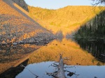
Unfortunately, my attempted traverse of the entire wilderness area from north-to-south didn’t go as planned. I completed the north half of the Cabinet Mountains Wilderness traverse, but I started to get some tendinitis in the knees and had to drop out at the halfway point. The knees were overstressed from some steep side routes I took with the heavy pack, but I still managed to have a fantastic time. I ended up spending 6 nights in the north half, every one of them in the beauty and peacefulness of the CMW under clear, starry skies. Dawn arrived with the calls of the Clark’s Nutcrackers on the ridges and the squeaks of the pikas on the talus slopes. I enjoyed many sunrises and sunsets with the mountains ablaze and their reflection on the lakes.
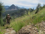
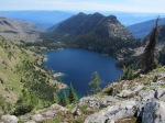
The route through the north half is greatly aided by a long ridge trail as part of the large trail complex near Libby, MT. This trail provides stunning views to the many lakes below and peaks above, past the Cedar Lakes, Dome Mountain, Parmenter Lake, the many untrailed drainages and lakes, and Sugarloaf Mountain towering above. The crown of the Wilderness, Snowshoe and A Peaks are always in view, drawing ever closer, with the Blackwell Glacier draping the slopes of Snowshoe. The trail ended at the Sky Lakes, but the ridge above these lakes is accessible and the high basin beyond is a paradise of small streams and bogs, where I saw a mountain goat and some mule deer. Beyond this basin is a ridge walk around to Gus Brink Mountain and Vimy Ridge/Vimy Lake at the base of A Peak. I did not complete the full ridge walk because I took a route down to Klatawa Lake below, but the section of the ridge that I skipped looked very manageable. As for the trip down to Klatawa Lake, it is one I’ll never forget. The route was steep and challenging and the reason for the tendinitis. The lake was one of the wildest places I’ve been to, with no recent sign of humans at the lake and the sounds of wildlife everywhere in the dense brush on the slopes surrounding the lake. Only game trails to follow around and up out of the lake through tall thickets of false huckleberry. Back up to the ridge, the shadows of Gus Brink mountain hold a lot of late season snow and there is a large bog with black pools and heavy elk traffic. After spending my last evening on Vimy Ridge, it was an easy hike down 4000′ to a trail along the North Fork of the Bull River where I exited and hitchhiked to my car.
Next Year the South Half Beckons
I look forward to doing the southern half next year, which will be more challenging since it doesn’t have the long ridge trail. For that trip, I will stick to the main route and save some of the steep off-trail explorations for another time with a lighter pack. My route across the southern half of the Cabinet Mountain Wilderness will head up the Middle Fork of the Bull River to Little Ibex Lake, over to Lentz Peak and a hopeful ridge hike around to the slopes of Elephant Peak before dropping to St. Paul Pass and Rock Lake, then up and over to Wanless Lake and out Swamp Creek. If this is too difficult, some forest roads may aid in bypassing some segments.
Happy trails,
Ken Vanden Heuvel


You must be logged in to post a comment.